
Backpacking the West Coast Trail is an adventure of a lifetime. I can’t say it enough.
The West Coast Trail claims to be one of the top backpacking trails in the world and with good reason – the quote below gives a pretty good description of the trail.
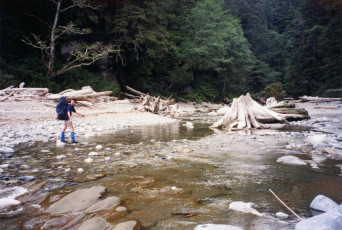
The West Coast Trail features a unique portion of Canada”s landscape and history. Winding atop cliffs, over sandstone shelves, through boulder beaches and into muddy rainforest the West Coast Trail is stunning, rugged and arduous. The spectacular scenery combined with a rich natural and cultural heritage make this area worthy of national park status and a unique experience for hikers that are physically and mentally prepared for the challenge.The West Coast Trail is a 75 km (47 mile) wilderness trail found on Vancouver Island that has a reputation of being one of the most grueling treks in North America. It is isolated,
 strenuous, physically demanding and potentially hazardous. Hiking the trail demands stamina, expertise in hiking and back country camping skills. You are required to wade rivers, use cable carts, negotiate steep slopes, climb ladders, traverse ravines, read tidal charts, hike on sandy beaches and follow an irregular, slippery trail. The trail is managed by a group in order to maintain the ecological integrity while minimizing human interference and as I mentioned, hazards are numerous. A great read of it can be found on Wikipedia.
It may take up to 24 hours or more before help arrives, should an accident occur so all hikers should carefully evaluate their individual and group abilities before attempting the West Coast Trail.
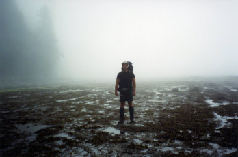
 On average, people take 6 to 7 days to backpack the West Coast Trail so my advice would be to plan your trek so as to have time to deal with unforeseen delays as well as enjoy the scenery and relax. The weather is characteristic of a marine temperate climate, rainfall averages 300 cm (120 in.) per year. The average summer temperature is 14 degrees Celsius (57 F) and heavy morning fog is very common, especially in July and August. A solid week of rain can make hiking the West Coast Trail a very unpleasant experience and flood waters will almost certainly delay hikers at some river crossings.
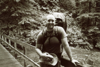
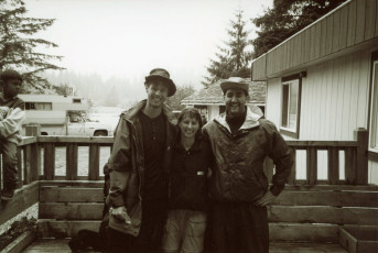
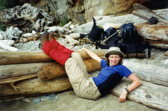
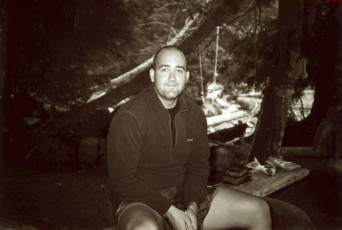
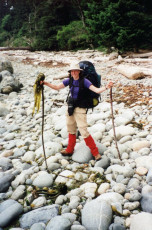
My traveling partners for this extraordinary trip were none other than my two trusty backpacking partners, Chris and Sarah. Big surprise. Not. Chris, Sarah and I have done most of our trips together and will do so for probably the rest of our lives. We share many common attitudes towards life and secretly enjoy pushing ourselves at a relentless pace while seeing as much of of nature as we can.
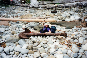
Chris, Sarah and I had made a promise after our first disastrous backpacking  trip that we would raise our outdoor skills and endurance so we could tackle the West Coast trail which was a legendary trip among backpackers. Two years later, we found ourselves camped out on the beach at Pachena Bay which is the northern start point for the West Coast Trail. All of our camping was done on the beach and by the end of our six day trek, everything we owned would have sand in it. And I mean everything.
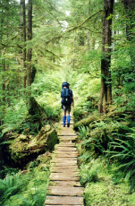
We experienced a LOT over the course of those six days and while I could write a small book on it, I won’t. Instead, I’m going to list some highlights for you and let you explore it through my photos.
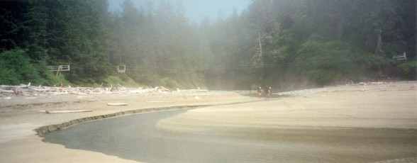
The Scenery
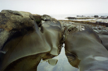
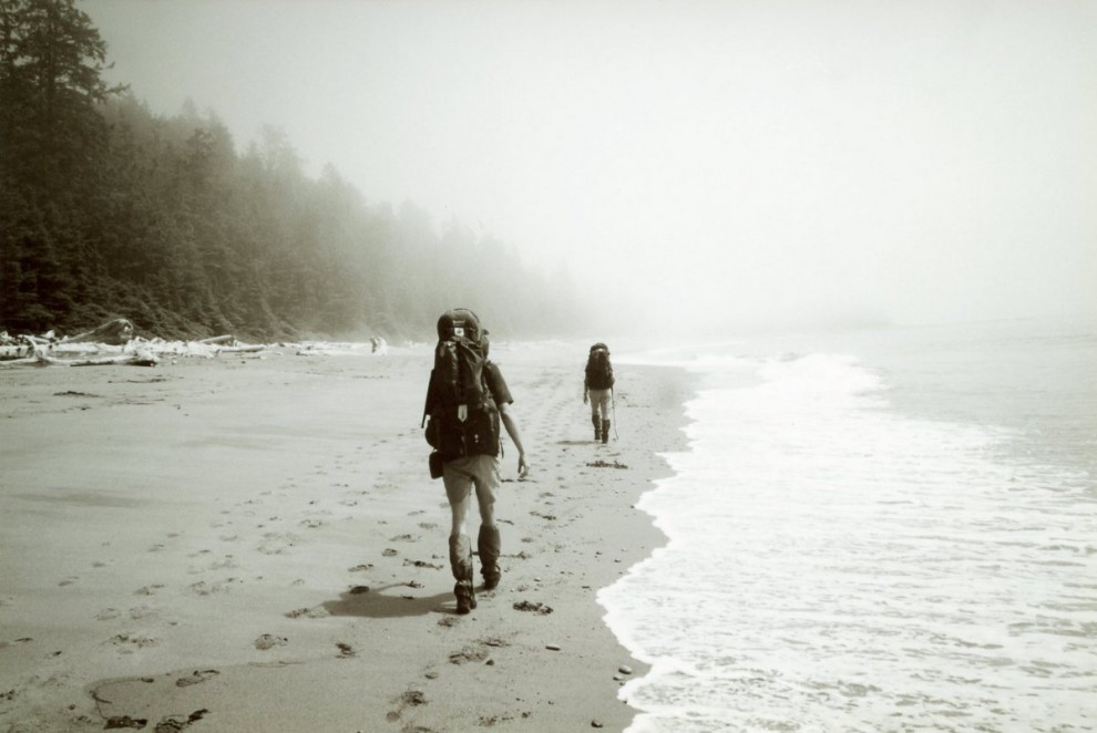
 Words cannot really describe what we saw there in terms of trees, plants and animal life (mostly aquatic). While we hiked, I got the sense that we were in another part of the world. At some points, it felt like I was in Amazon like conditions and couldn’t believe that I was still in Canada. The crashing ocean, the gigantic trees, the lush vegetation and the abundance of sea life was something all new to us and we felt like children because everything was new to us. At the end of each day, I would nap for about 30 minutes (I still don’t know what Chris and Sarah did during that time) but when I woke, we would leave our gear and the three of us would go for a one hour exploration tour up and down the beach.
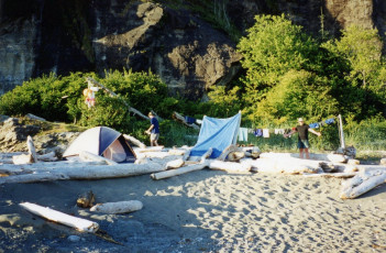
Beach Camping
We camped on the beach every single night which was great as I have never done that before. Every morning  we had the joy of waking to the sound of the crashing waves and every morning, we had the annoyance of finding yet more sand in everything we owned. The campsites are fairly large so even though there are other hikers around, you don’t typically hear or see them unless it gets really crowed which we did not encounter (I’ve seen some
  pictures of pretty busy campsites though). We even lucked out one night where we got to put our tent into a half cave which was nice had it rained. I half hoped it would just so I could say that we were prepared but alas, it was a dry night. At the end of each day, which consisted of 7-10 hours of backpacking, we would each fall into our roles to help set up camp and prepare dinner. By the 3rd day, we knew what we had to do and it worked out quite well for us. Nothing beat kicking up your feet and eating a hot meal after a long day on the trail. Hopefully the pictures do justice to what I saw because it has to be seen to understand it.
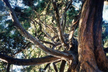
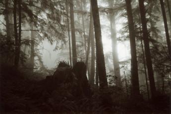
Giant Trees and Slippery Logs
 Simply put, the trees were enormous. Not sequoia enormous but still quite large. Anyone who has been out to British Columbia can attest to that but some of these trees made you feel quite small. When some of the larger trees would inevitably fall, you could see the damage they wrought to the surrounding area and sometimes they had fallen across the trail. When on their side, some of the trees were about seven to eight high! Fortunately, people cut steps into the tree so you can go over top of it instead of trying to get around by going through the underbrush (which is pretty near impassable in some areas) If I remember correctly, some trees had about 6-7 good-sized steps cut into them so you can get over which gives you an idea of how big they are.
The Adrenaline Surge Channel
The Adrenaline Surge channel was quite likely the most dangerous point on the trail. Before our trip we read about it and read stories about shaken trekkers with skinned knees and soaked packs who did not give this crossing the respect it deserved. To cross it
Simply put, this trip was the best backpacking trip I have ever done.Darcythere is a method that involves three people, some rope and some good climbing/swimming skills.
People have died there and we weren’t going to take any chances so we took the inland trail for this section even though it added about an hour onto our daily hike. On the day that we passed the channel, Chris, Sarah and I setup camp on the beach and hiked back down the beach so we could see this infamous surge channel. To be honest, I’m glad we didn’t attempt to cross it. It would have been fun but not so much fun if we had slipped on the rocks and fallen in.
Fresh crab
Around the halfway mark, there is a huge river which you must ferry across by using the services of some local natives from a nearby reservation. During  one of our crossing, the natives asked us if we wanted to join them on their crab fishing run. We jumped at the chance and while we sat in their boat, they worked their crab line and showed us how they choose which crabs to keep and which ones to throw back. After picking out the choice ones, we went back to the docks and the crabs were cooked on the spot in a giant pot. For a meager fee, we were rewarded with fresh buttered crab and beer. After 3 days of backpacking, this was the best tasting meal I have ever had! I even bought an extra beer to drink in a day or 2 but I ended up using it to barter with someone who had some Imodium (no need to delve further into that story – I think it’s quite self-explanatory)
Stinky Dead Whale
 Before we started the hike, we were told at the trail head that there was a beached whale about 2/3 of the way down the trail and that it has started to decompose. We eventually found it thanks to the pungent smell in the air but we almost missed it because it was 1/2 buried in sand.
As I stood there looking at the rotting bloated carcass, I thought the smell wasn’t too bad. That was until I went to the other side of the whale to get a closer look at it. That side was uncovered and it lay exposed to all of mother natures critters (mostly insects at this point) who were having quite a feast. It was at that moment that I began to struggle with my gag reflex every time I breathed in. Needless to say, we moved away from it quite quickly.
Extra fuel stops (aka Food)
You wouldn’t believe it but there are three spots on the trail where you can stop and buy additional food in case you need it. You know, in case you didn’t bring enough or in my case, your two daily energy bars were snatched away by giant crows as I left them unattended for a few minutes. Regardless of the reason, each stop is worth it and a chance to sample some delicacies on the trail.
- Chez Monique: A coffee bar in the middle of nowhere – they server burgers, fries and have a donation bin for you to put food in for other travelers.
- Pachena Point lighthouse: Homemade fudge! Who can say no to that?
- Nitinat Narrows: Pop, beer and fresh crab if you time it right (which we did)
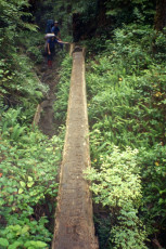
Cable Carts and Suspensions Bridges
 Without a doubt, these devices added a tremendous amount of adventure to the trip. Every once in a while, we would happen upon a river where the only way to cross it (without getting wet) as to hop in a cable car and ride it down to the middle of the river. You would then have to pull the cart with a rope over a sometimes raging river and you would then hop onto a platform and then send the cable car back where someone else could then pull it in and follow you. It was every bit as fun as I imagined it would be.
The types of bridges varied from  simple wooden ones to the elaborate suspension. The few suspension bridges we encountered along the way and were quite interesting. The Cheewat bridge was quite wide and relatively close to the ground while the Logan Creek Suspension bridge soared up high and had a single beam that you would walk upon to cross the canyon/ravine. The Logan Creek suspension bridge left me was a good one as it made you feel quite vulnerable even though it was quite sturdy. This gave the trip a +1 on the fun factor for sure.
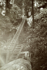
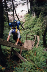
Ladders and Ravine Crossings
 Aside from the cable cars and suspension bridges, there were lots of ladders to climb up and down. They would sometimes elicit a groan from us when we saw them because you knew you would be pretty tired by the time you reached the top. The challenge they issued
  could never be ignored though and I looked forward to the big ones. I say challenge because at some point, we climbed up 200 feet of ladders while carrying our hefty backpacks.
We also happened upon a number of ravines that we had to cross. The bigger ones had a suspension bridge or even a regular wooden one but a few of them simply had us dropping down into them and then climbing up the other side. When it did rain, these would be brutal as they were extremely slippery from the mud and some of them even had ropes to help pull yourself up. A few of the ravines (usually 8-10 feet deep) had logs across them so that the more adventurous traveler could speed things up if they were so inclined to use it. While the log had been cut into a squarish shape to make walking on it a bit easier, the moisture and moss were working against you. Most of the time, we took the log route but there were a few times I opted for the muddy and tough way down into the ravine.
The Almost Black Bear Incident
 We were quietly eating lunch on the first day of the trail, when all of a sudden we saw two young guys come racing around a bend on the beach. There were carrying a pot in each hand and wore an expression of fear. After they reached us, they sat down, caught their breath and told us that they were cooking lunch on the beach a bit further down when they noticed a black bear lumbering towards them. They tried the usual tactic of yelling at it but to no avail so they took their food off the burner and dumped it onto the ground to distract the bear. While the bear gobbled up the food, they grabbed their gear and took off down the beach and a couple of kilometers later, they stumbled upon us. We were a little nervous because we were heading in the direction they had come from but as the day went on, we never saw or heard anything else about the bear. Aside from this and one small incident where Sarah and I noticed a bear hanging from a tree about 30 feet off the path, we did not have any encounters with the wildlife. (whew!)
Tsusiat Falls

As we arrived into our camp on the beach one day, we were amazed to see a set of waterfalls about 200 meters away from the main campsite. Compared to the Pacific, the water from the falls was warm and it was something right out of a holiday getaway resort but without the crowds. We played in the falls for quite a while and even sat on some natural rock chairs behind the falls while we talked with other backpackers. It was at this point that Chris and I thought we could handle swimming in the Pacific Ocean so we dipped our feet in for a bit. It was so cold that within 45 seconds, our feet had pains shooting through them. We decided to back to the falls to warm up and have some more fresh water fun.
In hindsight, it would have been nice to lounge here for an extra day because of the falls and the wide open section of the beach that you can explore.
Banana Slugs
The number one source of injuries on the West Coat Trail is not caused because of  animals attacks, bad trail conditions or hiker inexperience. It is from Banana Slugs. These little guys can grow up to several inches long and they are found all over the trail. People will be walking along and not see them until they step on them. They are quite mushy so when you do step on them, you tend to skid, slip and fall which is when the injuries take place.
Keep your eyes open and your backpacks closed when you are at camp otherwise, you might find one of these guys in there!
Closing Thoughts
This is the best backpacking trip I have every done and cannot recommend it enough to people who are able to do it. The only other trip that has come close to this one was a 6 day trip in Gros Morne National Park that I also did with Chris and Sarah but the West Coast Trail is unmatched in my books. The varied terrain, spectacular forest-beach-ocean views, beach camping and the numerous obstacles make you feel like a true adventurer.
Additional Photos